


You are now at the heart of the industrial district.
At its peak in the late 1940s, Dundas and
Carlaw would have hummed with railway activity, vehicular traffic, and workers arriving and leaving after their shifts on the Queen and Carlton streetcars.

At its peak in the late 1940s, Dundas and Carlaw would have hummed with railway activity, vehicular traffic, and workers arriving and leaving after their shifts on the Queen and Carlton streetcars.
Dundas + Carlaw
Intersection
Year:
1954
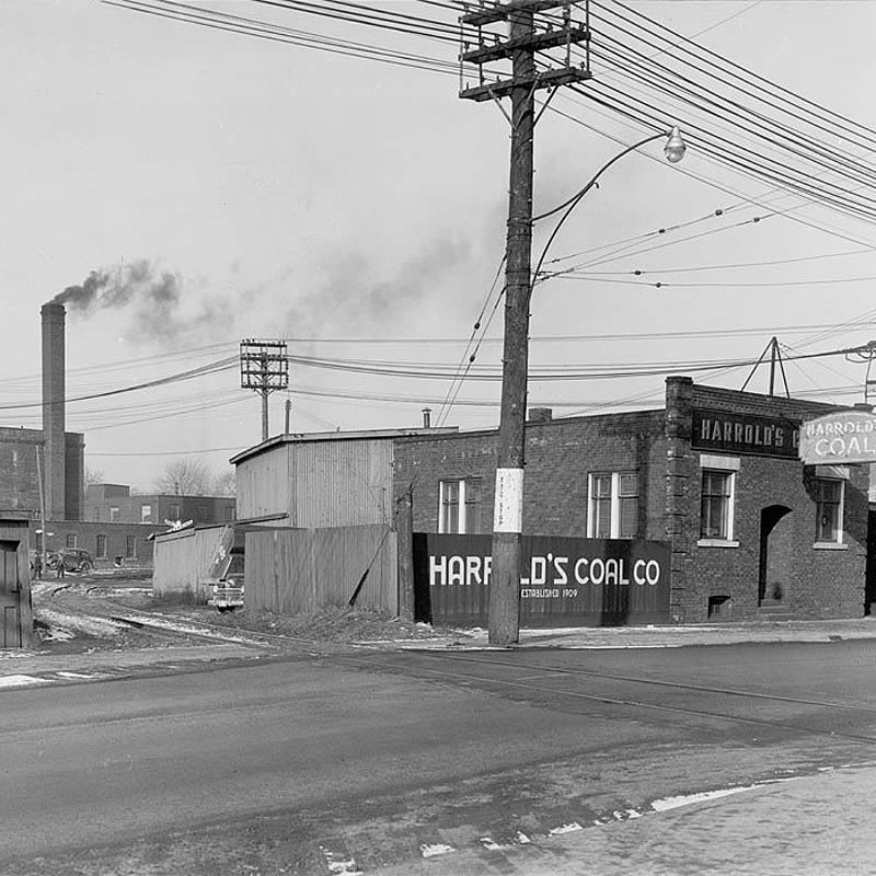
Left: Harrold’s Coal Co., 346 Carlaw Ave.
looking northwest to the future site of the
Dundas and Carlaw intersection.
City of Toronto Department of Public Works
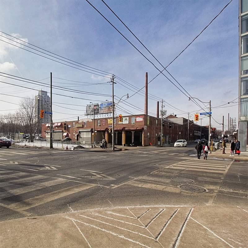
Right: Dundas St. E. and Carlaw Ave.
intersection seen from the southeast corner, March 2019.
Image by Susan Drysdale
You might have smelled sweets, rubber, or harsh fumes from soap making. Smoke from factory chimneys filled the air.
Many workers also lived nearby, thanks to a boom in new homes built in the 1920s. When money was tight during the Great Depression, commuters would walk or only take the streetcar one way.
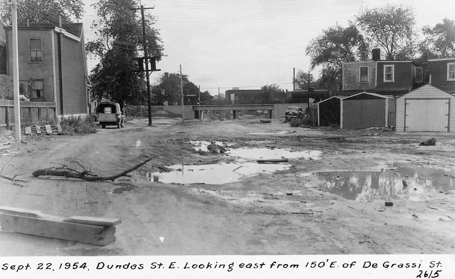
Construction of Dundas St. E., looking towards the intersection with Carlaw Ave., September 1954.
City of Toronto Archives
Before the 1950s, this intersection did not exist
because this part of Dundas St. hadn’t been built.
The street was extended through here to ease rush-hour traffic in and out of downtown. In the process, the Woods factory, our next stop, was split in half.
The rail network that dominated the Dundas and Carlaw area supported the factories.
It made industry here attractive, but it was also one of the reasons why the neighbourhood began to decline.
It made industry here attractive, but it was also one of the reasons why the neighbourhood began to decline.
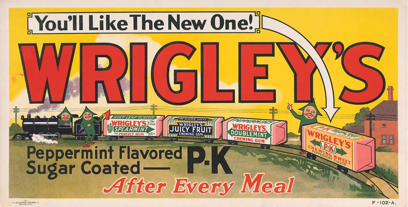
Wrigley advertisement for Spearmint, Doublemint,
Juicy Fruit and the new P. K. gum, 1921.
Wrigley
In the 1960s, trucking became cheaper and more convenient compared to rail.
Many businesses moved to factories in the suburbs to be closer to highways.
Rail loading dock at Wrigley, 1915
Wrigley
Rail loading dock at Wrigley, 1915
Wrigley

Not all the trains are gone.
The former GTR railway is used today by passenger trains on the GO Transit Lakeshore East line between Union Station and Oshawa, east of Toronto, and Via Rail trains on the busy Quebec City–Windsor route.
This triangle of land
is transforming.
It will soon become a public plaza with art inspired by the neighbourhood’s industrial heritage and railway legacy. This includes a 9.2-metre brick obelisk by internationally-acclaimed artist Pierre Poussin.
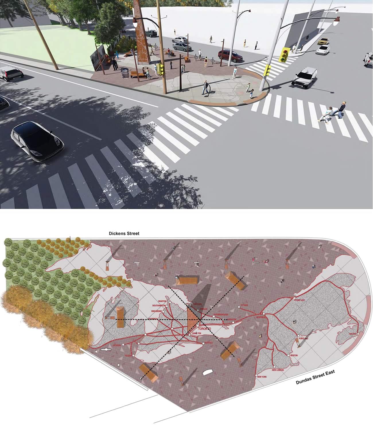
Concepts for the redesign of the Dundas + Carlaw triangle by artist Pierre Poussin, 2018.
The pavement design illustrates the railway network that made the neighbourhood thrive.
Concepts for the redesign of the Dundas + Carlaw triangle by artist Pierre Poussin, 2018.

Check
it out ...
Curvy condos
Check out the condo buildings at the southeast corner of the intersection. A freight track used to come right through this intersection en route to the backs of the factories on the east side of Carlaw. Although the track is gone, the shapes of these recent condo buildings reflect its path.
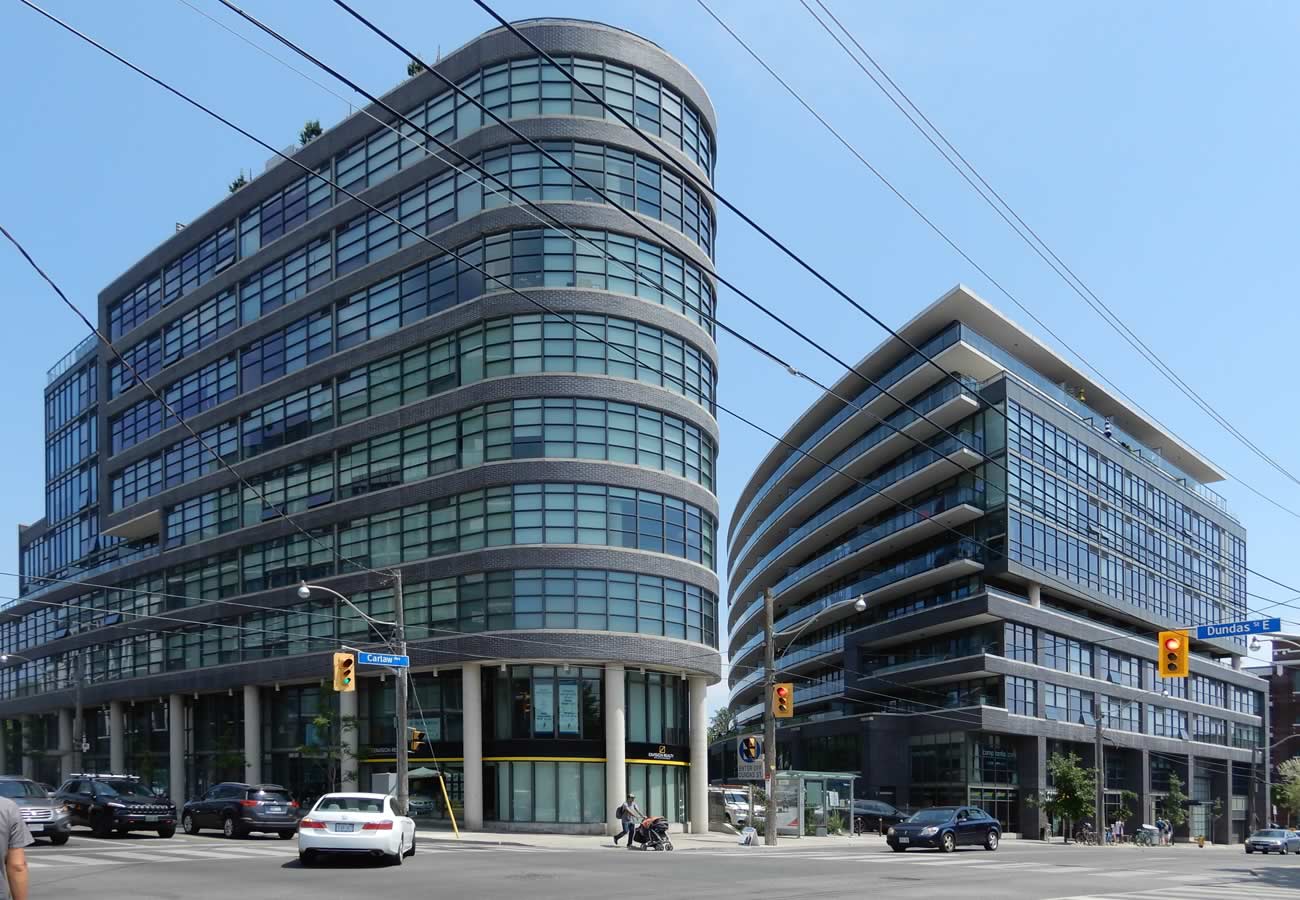
Curvy condos at Dundas St. and Carlaw Ave., June 2018
Image by Susan Roden


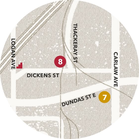
Ready to hit the next stop?
Staying on the south side of the street, head west on Dundas towards Logan Ave. On the way you will pass a mural - more on this at our next stop. Once you reach Logan Ave., head north at the lights. A plaque about our next stop, the Woods building, is located on the corner. Check it out on your way!
Continue north on Logan Ave. until you see a small set of stairs* on your right. Head up the stairs - at the top, look up at the Woods building and tower - this is your next stop.
* If you do not wish to use stairs, turn back to Dundas St. and head east towards Carlaw Ave. Once you reach Carlaw Ave., proceed north to Dickens St. Head west on Dickens St. until you see the Woods building and tower. You are at the next stop.
Careful! This is still and industrial area and there are no sidewalks, be mindful of traffic.
Full steam
ahead!